Our services
Building control geodetic topo photos
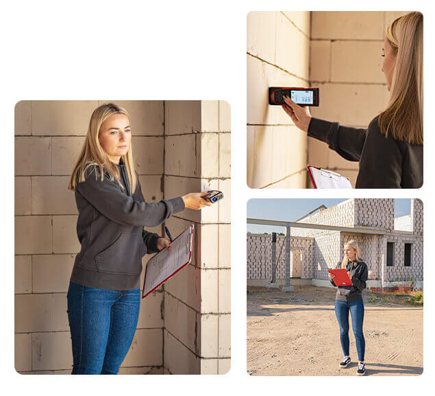
Geodetic photographs of buildings are essential for construction work. When the construction of buildings for various purposes is completed, a Building Control Survey is a special geodetic survey.
The law of the Republic of Lithuania stipulates that structures may be put into operation once the measurements have been made and the geodetic (also known as control) photograph of the structure has been agreed. Geodetic control (execution) photographs are required for the measurement of buildings, building structures (trusses, columns, etc.). Geodetic surveys are also required for engineering structures and engineering networks.
We take fast and accurate building control geodetic photographs, which help to professionally assess the current situation and the quality of construction works. Topographic surveys are geodetic surveys carried out after the construction process is complete. These control measurements make it possible to determine accurately and promptly whether the planned design has been followed during construction and whether there are any deviations from the established plans.
High-quality equipment
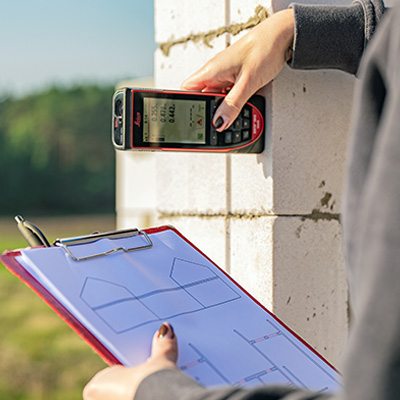
The work is carried out using high-precision measuring instruments and specialised software. Electronic tacheometers and GPS (Global Positioning System) receivers are used for measurements.
GEODEZINIAI MATAVIMAI
Our services
Upon receipt of your order, after a prompt assessment of the situation, based on your needs, we will:
Geodetic control photographs of buildings
Building control geodetic surveys will provide a professional assessment of the current situation - the quality of the construction work carried out after the completion of the various buildings. These building control surveys will quickly and accurately assess whether there have been any deviations from the intended plan during construction.
Geodetic control photographs for utility networks
The national coordinate system governs measurements. It determines whether the buildings constructed comply with the technical design, whether the distances from the boundaries have been maintained, and whether the fences are in line with the intended boundaries of the plot.
Consultations
We advise on all issues related to geodetic control photographs of buildings and geodetic control photographs of engineering networks. Contact us and get high quality services.
Documents
The following documents must be prepared before the geodetic survey of the structure is carried out

Plan of the existing land parcel
Extract from the real estate register
Technical design of the building or a drawing prepared
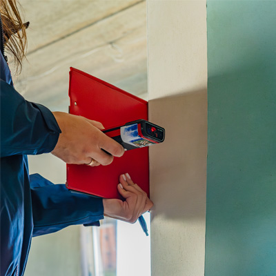
Only suitably qualified professionals may take control photographs of structures. The photographs are taken using highly accurate equipment and professional instruments.
Surveyors taking building control geodetic photographs must meet certain requirements: they must have a university degree and a qualification certificate for surveyors and geodesists issued by the National Land Service under the Ministry of Agriculture. The qualifications of our employees are continuously upgraded through various training courses and adapted to the latest standards for topographic photography. The work of all specialists is subject to inspection and strict control. All geodetic photographs and other surveying works are carried out in compliance with all applicable legislation and standards in Lithuania.
Our team performs geodetic surveys for building control in a prompt and precise manner, which allows us to professionally assess the current situation and determine the quality of the construction work performed. Topographic photographs are important geodetic measurements needed to properly complete the construction process. Our experienced professionals carry out these control measurements of structures accurately and to a high standard, ensuring a quick and reliable assessment of compliance with the construction plan.
All our measurements are carried out in accordance with the national coordinate system. We ensure that all measurements are accurately provided, including the distances of buildings, plots and other objects and the necessary data.
The price of a topographic survey depends on the size of the area to be surveyed and the desired timeframe. Our professional surveyors can usually produce a topographic photo within two weeks.
Our company uses high-precision surveying equipment and continuously updated specialised software. We use electronic tacheometers and GPS receivers to ensure highly accurate and clear results. This equipment allows us to guarantee the highest quality of work, so our clients can rest assured that all measurements will be carried out with perfect accuracy.
We take care of the whole process of preparing topographic (geodetic) photographs:
We collect all the necessary information from the organisations that maintain the engineering networks (communications).
We take accurate measurements of your plot.
We check the plans and coordinate them with the same organisations that confirm that the information they have provided is accurately represented in the final toponymic image.
Contact us now! We will be happy to assist you in all matters related to topographic (geodetic) photographs, from collecting archive material and taking measurements to submitting and approving documents to the relevant authorities.