Our services
Other surveying services
The "Geodeziniai matavimai" team of surveyors is always ready to assist you in addressing various land management, cadastral measurement, and document processing issues. We aim to ensure high-quality services at a competitive price.
We offer free consultations in the field of land management and provide advice related to real estate.
Our specialists are prepared to carry out measurements of buildings and land plots of varying complexity. Since the beginning of our operations, we have served over 5000 clients, many of whom choose us again.
We adhere to the principles of environmental friendliness and sustainable consumption, and our extensive experience, modern technologies, and broad knowledge base help us achieve these goals. We are happy to consult on construction and material selection issues or recommend reliable specialists.
High-quality equipment
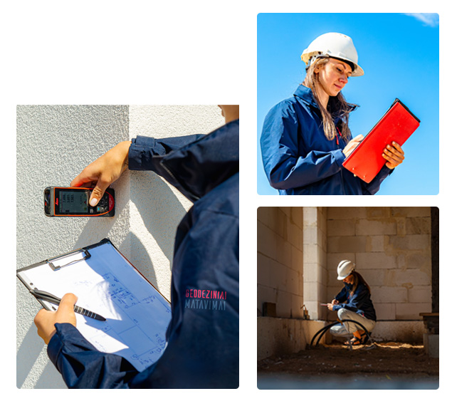
The work is carried out using high-precision measuring instruments and specialised software. Electronic tacheometers and GPS (Global Positioning System) receivers are used for measurements.
Geodeziniai matavimai
Services
We will provide a free consultation, professionally conduct measurements of buildings and land plots, and provide information about the materials used.
Free consultations
We will provide free consultations on all land management and real estate matters.
Measurements of buildings and land plots
We perform measurements of buildings and land plots for projects of various complexities. Throughout our long period of operation, we have served more than 5000 clients, many of whom return to us again.
Materiality
We provide construction and material consultations, and we can also recommend reliable specialists.
Cadastral measurements:
they can only be performed by individuals holding a Surveyor qualification certificate. These measurements include:
- land cadastral measurements,
- building cadastral measurements.
Geodetic measurements:
- they are carried out by specialists with Geodetic qualifications, who perform:
- topographic (topo) surveys,
- as-built surveys,
- well cards,
- marking of structures on site.
If you have a land plot, you may require the following measurements:
- Cadastral measurements of the land plot – to accurately determine the boundaries and area of the plot.
- Formation and restructuring project – when planning to divide or separate plots.
- Restoration of boundary markers – to restore lost or damaged boundary markers of the plot.
When designing buildings, carrying out construction, or handing over the object, the following measurements may be necessary:
- Topographic survey – essential in preparation for construction, to accurately assess the terrain and existing conditions.
- Site marking of buildings – helps to precisely determine the locations of buildings during construction.
Control geodetic survey:
- for the purpose of handing over the building;
- to assess existing engineering communications.
Cadastral measurements of the building (inventory) – necessary for the official registration of the building and data verification.