Our services
Cadastral surveys
Since the company's inception, we have prepared more than 5,000 cadastral survey files covering almost 10,000 hectares of land. We carry out cadastral surveys of land plots, buildings, premises and engineering structures.
Cadastral surveys are a procedure for determining the real estate object, the boundaries of the land plot, the coordinates of the boundaries of the buildings on the plot and other technical dimensions and geometric features.
Our team of qualified surveyors and land surveyors ensures accurate and professional work using the most advanced equipment. We give each client exceptional attention and continuously improve our skills and processes.
If you are planning to register a plot of land or other immovable property, you need a cadastral data file, for which data is collected during cadastral surveys.
High-quality equipment
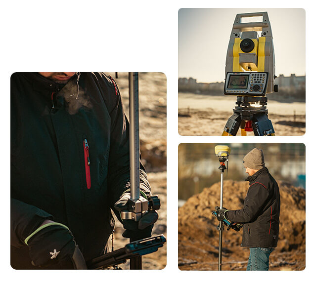
The work is carried out using high-precision measuring instruments and specialised software. Electronic tacheometers and GPS (Global Positioning System) receivers are used for measurements.
GEODEZINIAI MATAVIMAI
Services
The processes are carried out in accordance with the legislation of the Republic of Lithuania. For cadastral surveys, the Geodeziniai matavimai team is ready to help you!
Cadastral measurements of land parcels
Preparation of cadastral survey files for residential, agricultural, commercial, industrial and warehousing, and public land plots.
Cadastral surveys
Cadastral surveys after detailed plans or land-formation projects.
Cadastral characteristics
Updating cadastral indexes, at the request of the owner or authorised person.
Cadastral measurements of buildings
Cadastral measurements of buildings: residential, garden, commercial, industrial and public buildings.
Engineering structures
Cadastral measurements of engineering structures (roads, bridges, engineering networks, etc.).
Apartments and premises
Cadastral measurements of flats and premises.
Documents
reikalingi kadastriniams (geodeziniams) matavimams atlikti

Cadastral certificate (legal registration)
Preliminary or detailed site plan and, if available, cadastral certificates for buildings
Land acquisition documents
Cadastral (geodetic) surveys are a process for identifying real estate, land, boundaries, coordinates of buildings, boundaries of plots and other technical and geometric data. These measurements allow the precise calculation of the area of the land parcel and the land uses thereon and the establishment of other cadastral data.
When subdivision or consolidation of plots is carried out;
When a parcel of land is sold, leased or transferred for use;
When the boundaries and area of a parcel need to be clarified in the Real Estate Register.
Surveyor: A person who holds a certificate of qualification to establish cadastral data for immovable property.
Surveyor: A professional who carries out surveying work and is qualified to do so.
Amalgamation: The process of real estate transformation in which a part of a parcel of land is merged with another parcel of land without creating a new object.
Coordinates and boundary markers of the boundaries of the land parcel;
Calculation of the geometric parameters of parcel areas and structures;
Mapping of land contours;
Marking of land use restrictions and easements;
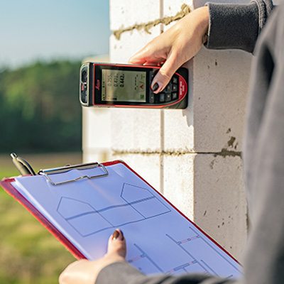
Preparation of plot plan and cadastral survey file.
The surveys are carried out using state-of-the-art equipment such as GPS receivers and laser tacheometers to ensure accuracy.
Cadastral surveying is a broader term that covers the measurement of land parcels, buildings and other objects. Geodetic surveying is a specific service for determining the exact details of a land parcel.
Collecting information: data is collected on the boundaries of the parcel to be surveyed and the boundaries of adjacent parcels.
Measurements: Accurate measurements of the territory are taken.
Marking: A date for marking the parcel is agreed with the owner and notices are sent to all interested parties.
On-site measurements: Establishment of plot boundaries, boundary markers.
Drawing up of the plan: A plan of the land plot is drawn up and checked with the National Land Office.
Registration: The data is submitted to the Centre of Registers.
All work is carried out in accordance with the law and using modern technology. If you need cadastral surveys, contact our team for professional and prompt services!