Our services
Topographic photo (geodetic photos)
We carry out geodetic surveys throughout Lithuania for both private and legal entities, ensuring high quality and competitive prices. In addition, we provide free consultations on all land management issues.
Geodetic surveys are required in the following cases:
- When buying or selling land plots;
- When constructing new buildings;
- Changing the use of land.
We guarantee accurately shaped and measured land plots, precise plans, preparation of all documents required by the Centre of Registers.
High-quality equipment
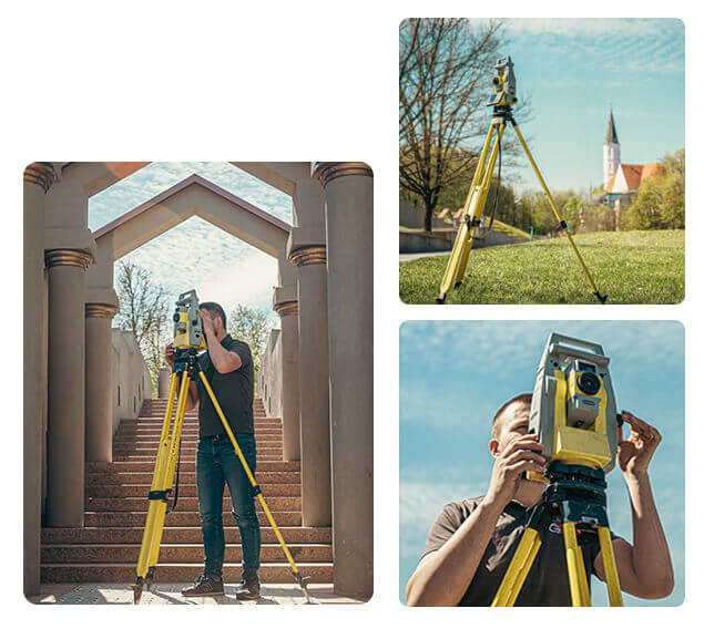
The work is carried out using high-precision measuring instruments and specialised software. Electronic tacheometers and GPS (Global Positioning System) receivers are used for measurements.
GEODEZINIAI MATAVIMAI
Services
The processes are carried out in accordance with the legislation of the Republic of Lithuania. For cadastral surveys, the Geodeziniai matavimai team is ready to help you!
Topographical photos
Preparation of topographic photographs in various areas: built-up, unbuilt-up, forests, water bodies and mineral deposits (quarries).
Utility manhole cards
We draw up manhole cards for engineering networks.
Geodetic control photographs
Geodetic photographs of buildings and their structures (e.g. trusses, columns), engineering structures and networks.
Marking in the field
Marking of building axes, engineering structures and networks.
Marking the boundaries of parcels of land
Restoring boundary markers.
Consultations
We provide advice on all aspects of topographic and geodetic photography.
Documents
required for geodetic surveys of land parcels

Land parcel plan
Certificate of registration of immovable property and rights in rem in the immovable property register
Legal documents for property formation
Cadastral survey files for buildings and structures on the land (if any)
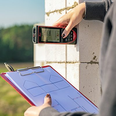
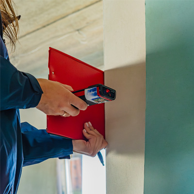
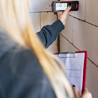
A topographic photograph is a special drawing that accurately depicts the existing above- and below-ground situation on a given piece of land. It is essential for the design or reconstruction of buildings and structures, for the design of underground communications, and for the preparation of land-formation and land-use plans. Examples of topographical photographs are given below.
In order to start the design work, the topographic photograph must be agreed with all the organisations that operate the engineering networks, as well as with the municipality. For this reason, it is important to plan the ordering of a topographic photo in advance, as the coordination process can be time-consuming.
Topographic photographs are also used to check that the buildings constructed are in accordance with the technical designs, that the distances from the boundaries of the plot are maintained, that fences do not overstep the boundaries etc. It is important to know that a topographic photograph has a validity period, which, according to the Building Regulation, is usually between 1 and 3 years.
Topographic photographs (also known as topographic plans) can be produced in either analogue or digital format. They may be at scales of 1:500, 1:1000, 1:2000 or 1:5000, depending on the characteristics of the terrain and the nature of the structures to be designed. These scales shall be chosen in accordance with the requirements laid down in the Regulation on the approval of the Technical Requirements Regulation GKTR 2.08.01:2000. The scale also determines which objects will be included in the plan, such as buildings, structures, auxiliary streets, fences, hedges, underground structures, etc.
Topographical plans contain additional information such as the purpose of buildings, wall material, number of storeys and other specific data. Explanatory notes, conventional signs, representations of features, contours and relief, and official names of geographical features (e.g. settlements, streets, rivers, lakes) are also included.
Topographic photographs can only be taken by suitably qualified specialists using highly accurate equipment and specialised instruments "Geodetic surveying" specialists take topographic photographs of various areas: built-up and unbuilt-up areas, forests, water bodies and mineral deposits (quarries).
is the spatial positioning of engineering networks by means of geodetic surveys. It indicates the distances from fixed elements of the situation and the subsidence of the networks from the ground surface. These photographs are necessary for the commissioning of the network, as they must be taken and agreed in accordance with the established procedures.
The price of a topographic image depends on the area and the speed of delivery required. Our professional surveyors can usually produce a photo within two weeks.
During this period the following work is carried out:
The surveyor collects all the necessary information from the organisations maintaining the engineering networks (communications).
Geodetic measurements are taken on your plot.
Plans are drawn up.
The plans are coordinated with the network maintenance organisations (they confirm that the information is accurately depicted in the final topographic image).
The plans are coordinated with the municipality in whose territory your plot is located.